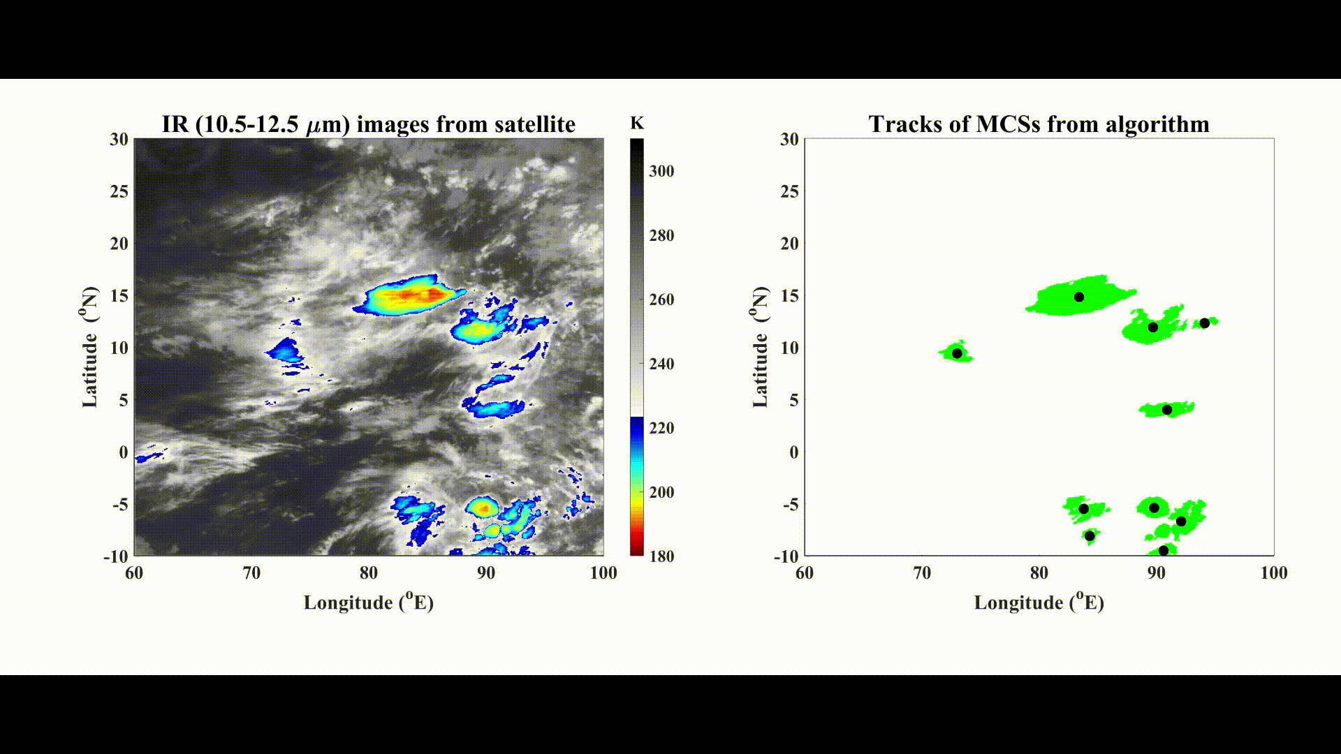
This MATLAB package extracts depp cloud systems (CSs) from gridded IR images of a geostationary satellite. The tracking is based on the overlap technique (Williams and Houze, 1987), where the continuity of CSs is decided according to the overlapped areas between two frames.
The tracking code and the tracked CSs dataset are available on my Github repository:
https://github.com/jayphd/Track_MCSs/
- For the INSAT-3D/3DR raw data, use Grid_data.m for geolocating and gridding the data.
- Run Track_CS.m for tracking of MCSs in the gridded dataset.
- MCSs are stored in .csv files in the ‘MCSs_dataset’ folder.
Note: The LAT-LON grid has been set to (1/12.5) degree spatial resolution. The native Kalpna-1 image resolution is 8 km. The native INSAT-3D/INSAT-3DR image resolution is 4 km. Modify the spatial resolution of the grid as needed.
Tracking dataset columns:
ID, Day, Month, Hour, Minutes, lat, lon, Area, ImageNumber, SplitParentID, MergeParentID, MergeChldArea, MinTemperature, CoreArea, AvgTemperature
References:
Phadtare, J. and Bhat, G.S., 2019. Characteristics of deep cloud systems under weak and strong synoptic forcing during the Indian summer monsoon season. Monthly Weather Review, 147(10), pp.3741-3758. DOI: https://doi.org/10.1175/MWR-D-18-0346.1
Williams, M., and R. A. Houze, 1987: Satellite-observed characteristics of winter monsoon cloud clusters. Mon. Wea. Rev., 115 (2), 505–519.
Contact: Jayesh Phadtare. jayesh.phadtare@gmail.com